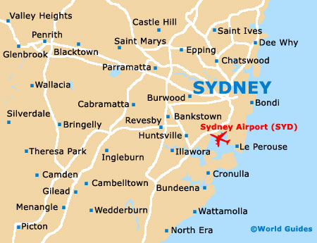
Sydney Airport (SYD)
City Orientation and Maps
(Sydney, New South Wales (NSW), Australia)
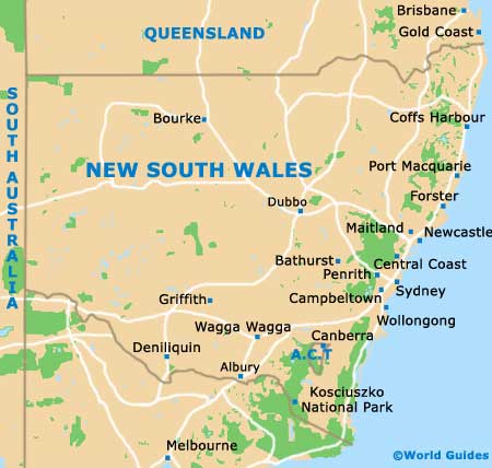
The city of Sydney is situated on the south-eastern coast of Australia, to the north of both Canberra and Melbourne. Located in the state of New South Wales, Sydney is edged on the eastern side by the Tasman Sea and lies close to Cessnock and Newcastle to the north, Bathurst and Lithgow to the north-west, Cambelltown, Bowral and Goulburn to the south-west, and both Ingleburn and Wollongong to the south. Sydney Airport (SYD) stands just minutes to the south of the city centre, directly above Botany Bay.
Sydney Airport (SYD) Maps: Important City Districts
Sydney Harbour divides the city into two main regions, being connected by both the Harbour Bridge and the Harbour Tunnel, which runs close to the Sydney Opera House, the Royal Botanic Gardens and Sydney Cove on the shore of the southern region. Many other important tourist attractions and places of interest can be found to the south of the main harbour area, including the city centre.
Central Sydney is fairly narrow and stretches between Circular Quay and Central Station, with Darling Harbour being located on the western side and numerous parklands and areas of green to the east. Also nearby are a number of important inner suburbs, such as the Darlinghurst, Paddington, Woollahra and Kings Cross districts. Those looking for the best beaches should head to the west, around the Bondi area, which is surprisingly close to Sydney Airport and Botany Bay.
On the western side of central Sydney lie a number of important and appealing neighbourhoods, such as Glebe and Pyrmont. Glebe is situated next to University of Sydney and is known for its relaxed atmosphere and laid-back attitude. Also nearby is the district of Newtown, where a number of scenic harbours, night clubs and local shops can be found.
Australia Map

New South Wales Map
Sydney Map